🏠 House Orientation Analysis
This project determines the orientation (direction) each house faces based on cadastral boundaries, road networks, and address data.
Pitch
This analysis identifies which direction every property faces (N, NE, E, SE, S, SW, W, NW) by combining geospatial analysis of property boundaries with road network data.
Visualization
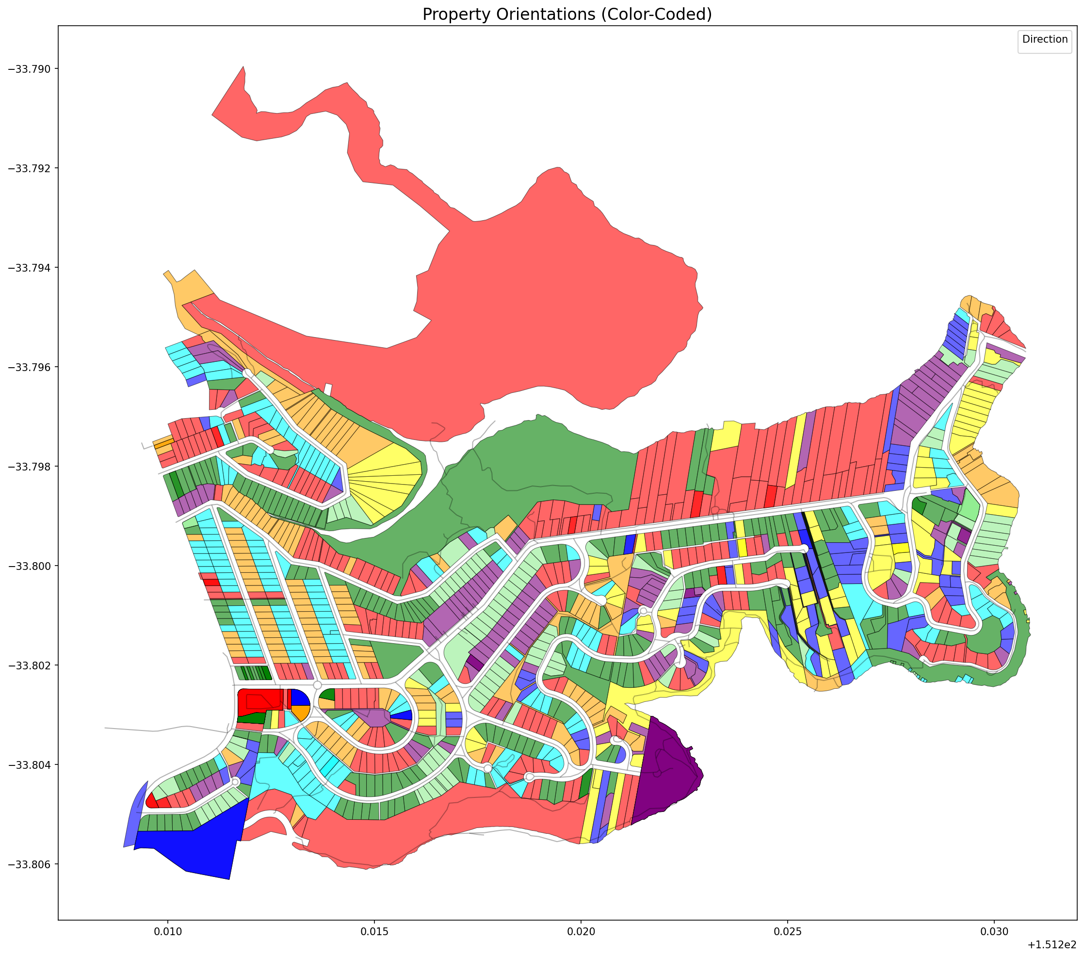
Properties color-coded by orientation: Red (N), Orange (NE), Yellow (E), Light Green (SE), Green (S), Cyan (SW), Blue (W), Purple (NW)
Sample Output
| state | sa4 | bearing | direction | method | confidence |
|---|---|---|---|---|---|
| NSW | Sydney - North Sydney and Hornsby | 4.10 | N | street-facing | high |
| NSW | Sydney - North Sydney and Hornsby | 38.46 | NE | street-facing | high |
| NSW | Sydney - North Sydney and Hornsby | 36.77 | NE | street-facing | high |
| NSW | Sydney - North Sydney and Hornsby | 332.93 | NW | street-facing | high |
| NSW | Sydney - North Sydney and Hornsby | 310.72 | NW | street-facing | high |
Overview
The analysis calculates which direction properties face (e.g., North, South, East, West) using multiple sophisticated methods:
1. Street-Facing Edge Method: Identifies the property edge closest to roads and calculates the perpendicular direction (most accurate for typical properties)
2. Longest Edge Method: Uses the longest boundary edge of the property (good fallback for properties without nearby roads)
3. PCA (Principal Component Analysis): Calculates the major axis of the property shape (best for irregular properties)
The combined method tries these in order and selects the best available result.
Features
- Multiple orientation calculation methods for robustness
- Configurable granularity (4, 8, or 16 directions)
- Confidence scoring for each calculation
- Both Jupyter notebook (interactive) and Python script (automated) interfaces
- Comprehensive visualizations and statistical analysis
- Reusable, modular code design